
Photo / Jim Neuger
Please do not leave this page until complete. This can take a few moments.
Interstate 95 traffic crosses the Maine-New Hampshire border on the Piscataqua River Bridge. Built in 1972, the six-lane span underwent a $62 million facelift that was completed in spring 2022. Some 78,000 vehicles use the bridge daily, rising to 130,000 vehicles during the summer tourist season, according to the Maine Department of Transportation.

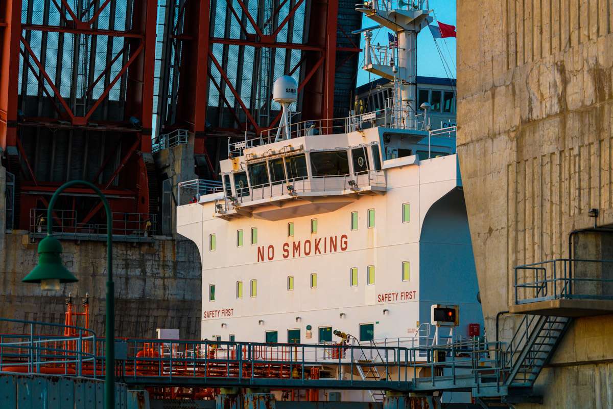
Bulk cargo, containers and petroleum products transit through the Port of Portland, the largest of Maine’s three cargo ports and the nearest American deep-water port to Europe. Nine terminals make up the facility, including the International Marine Terminal (shown here). Cargo is only part of the Portland waterfront story: passenger cruise ships dominate the harbor in the warmer months.

The more leisurely route across the Piscataqua River is the Sarah Mildred Long Bridge, carrying motor vehicles on the upper level and rail cargo below. Supported by four 200-foot-tall precast concrete towers, the current $159 million structure opened in 2018, replacing a bridge built in 1940, according to the Maine Department of Transportation. The bridge’s namesake served for half a century on the Maine-New Hampshire bridge management authority.

The fortunes of many towns in Maine’s interior have ebbed and flowed with the railroads that connect Canada with the Atlantic ports. The village of Brownville Junction grew up around the rail yard shown here. Now operated by Canadian Pacific, the rail hub sits on the shortest route between eastern Canada and principal markets in the U.S.
The Casco Bay Bridge opens up for a freighter to pass through en route to the Turners Island terminal of the Port of Portland, a spot on the infrastructure map since the construction of a rail link in 1847. The four-lane drawbridge is of newer vintage: it was built in 1997 to improve cargo access in Portland harbor.

Dating back to grass runways first used in the 1920s, Portland International Jetport is Maine’s largest airport, with nonstop flights to hubs primarily in the eastern U.S. As airlines add back connections that were canceled during the pandemic, traffic in 2022 is heading back toward the peak of 2.2 million passengers that was recorded in 2019, the jetport says.

Maine boasts 365 miles of interstate highways, running from Kittery in the south to Houlton on the Canadian border. Tolls apply on a roughly 100-mile stretch operated by the Maine Turnpike Authority. The last section of the highway network was completed in 1981. This photo shows traffic near Falmouth, close to the first section that opened in 1957.

Jim Neuger spent more than three decades in Europe, working as a print journalist in Germany and Belgium, before moving with his wife, fellow journalist (and Mainebiz Senior Writer) Renee Cordes, and their pet birds to Maine in 2016. Neuger now keeps himself busy as a freelance photographer, and with hobbies including running and sitting atop horses. Some of his work is on display at www.jimletpix.com.

The Giving Guide helps nonprofits have the opportunity to showcase and differentiate their organizations so that businesses better understand how they can contribute to a nonprofit’s mission and work.
Learn More
Work for ME is a workforce development tool to help Maine’s employers target Maine’s emerging workforce. Work for ME highlights each industry, its impact on Maine’s economy, the jobs available to entry-level workers, the training and education needed to get a career started.
Learn More
Whether you’re a developer, financer, architect, or industry enthusiast, Groundbreaking Maine is crafted to be your go-to source for valuable insights in Maine’s real estate and construction community.
Learn moreThe Giving Guide helps nonprofits have the opportunity to showcase and differentiate their organizations so that businesses better understand how they can contribute to a nonprofit’s mission and work.
Work for ME is a workforce development tool to help Maine’s employers target Maine’s emerging workforce. Work for ME highlights each industry, its impact on Maine’s economy, the jobs available to entry-level workers, the training and education needed to get a career started.
Whether you’re a developer, financer, architect, or industry enthusiast, Groundbreaking Maine is crafted to be your go-to source for valuable insights in Maine’s real estate and construction community.
In order to use this feature, we need some information from you. You can also login or register for a free account.
By clicking submit you are agreeing to our cookie usage and Privacy Policy
Already have an account? Login
Already have an account? Login
Want to create an account? Register
In order to use this feature, we need some information from you. You can also login or register for a free account.
By clicking submit you are agreeing to our cookie usage and Privacy Policy
Already have an account? Login
Already have an account? Login
Want to create an account? Register
This website uses cookies to ensure you get the best experience on our website. Our privacy policy
To ensure the best experience on our website, articles cannot be read without allowing cookies. Please allow cookies to continue reading. Our privacy policy


0 Comments