‘Wild and scenic’ listing could protect York River watershed
 Courtesy / State of Maine
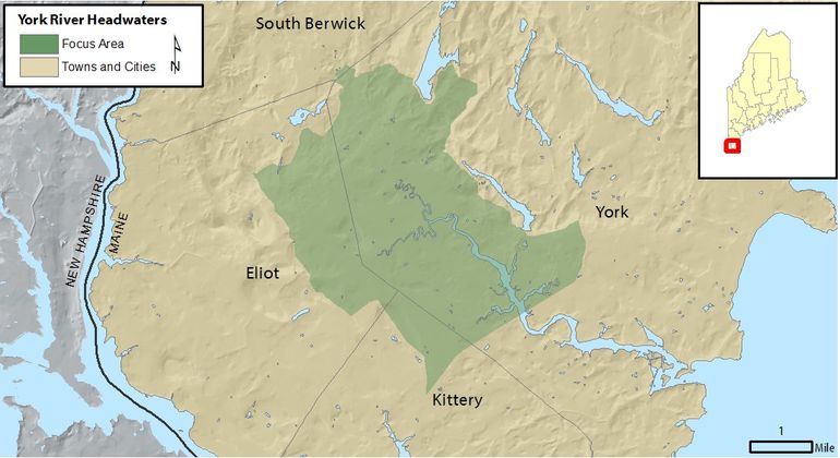
Seen here are the York River headwaters and watershed proposed for listing under the National Park System’s Wild and Scenic Rivers Program.
Courtesy / State of Maine
Seen here are the York River headwaters and watershed proposed for listing under the National Park System’s Wild and Scenic Rivers Program.
A pending addition of the York River to the National Park System’s Wild and Scenic Rivers Program could ultimately help protect the southern Maine watershed and lift its profile as a national tourism destination.
Maine’s Congressional delegation has reintroduced the bipartisan York River Wild and Scenic River Act to initiate the final step in the listing process, according to a news release
If the bill is passed by Congress and signed by President Joe Biden, the designation would direct more federal funding and technical assistance to the area, while lifting the York River’s profile as a national tourism destination. It would also provide a local forum for the four watershed communities to collaboratively address long-term river stewardship needs.
“After legislation to study it and years of outreach with the towns of York, Eliot, Kittery, and South Berwick and residents of the communities, it is clear how meaningful the river is to the character of the region,” according to a joint statement from U.S. Sens. Angus King, I-Maine, and Susan Collins, R-Maine, and U.S. Reps. Chellie Pingree, D-Maine 1st District, and Jared Golden, D-Maine 2nd District.
The bill is the culmination of a collaborative, decade-long effort that could deliver more federal funding to protect the river, which provides environmental and economic benefits to surrounding communities.
“The watershed — a shared York, Eliot, Kittery, and South Berwick resource — buffers us from intense regional development pressure and the pristine forested areas supply clean drinking water,” said Judy Spiller, a Kittery town councilor and chair of the York River Study Committee. “And in the future, if protected, the watershed will provide resilience in the face of rising sea levels.”
The river's healthy salt marshes capture and store carbon, provide important habitat for many species, and help mitigate coastal flooding.
Pingree and Golden originally introduced legislation to add York River to the list in 2019. King and Collins introduced companion legislation in 2020.
The bills followed a three-year study, funded by legislation that Pingree and King introduced in 2011 and Congress passed in 2014, conducted by local stakeholders. The study recommended the designation. In 2018, voters of York and Eliot overwhelmingly passed referendums to move forward with the designation, as did the town councils of Kittery and South Berwick.
The York River watershed covers 33 square miles in parts of South Berwick, Eliot, Kittery and York, according to the locally led, three-year York River Study, which concluded at the end of 2018 when votes were taken by communities to endorse designation and the York River Watershed Stewardship Plan.
According to the York River Study website, the tidal river is about 13 miles long and the watershed includes 109 miles of streams.
The river has its headwaters in South Berwick and flows to the Gulf of Maine. The watershed provide water to the residents of Kittery, the Portsmouth Naval Shipyard, and portions of York and Eliot.
According to the stewardship plan, the watershed is notable for historic structures and buildings, archaeological sites, scenic qualities, intact natural habitats, large forested areas, and ecological resilience.
It includes extensive salt marshes, rare plants and animals, drinking water supplies, undeveloped conservation lands, working waterfront and clean water that supports recreational activities and provides high-quality aquatic habitats.
While the river and watershed resources are generally healthy, there are threats population growth and development, invasive plant and animal species, increasing numbers of river users, sea level rise and other changing environmental conditions.
The York River Study Committee recommended pursuing a “Partnership Wild and Scenic River” designation, which could provide federal funding, technical assistance and a local forum for the four watershed communities to collaboratively address long-term river stewardship needs. The designation does not put land under federal control, require public access to private land, change existing land uses, force changes in local land use decision-making processes or objectives, create new federal permits or regulations, prevent access to or use of the river or watershed lands, or affect hunting and fishing laws.
The Wild and Scenic Rivers Act originally became law in 1968.
The Partnership Wild and Scenic Rivers flow through primarily privately-owned, not federally-owned, lands. Communities work in partnership with the National Park Service.
Mainebiz web partners
Most Recent


Most Recent


0 Comments