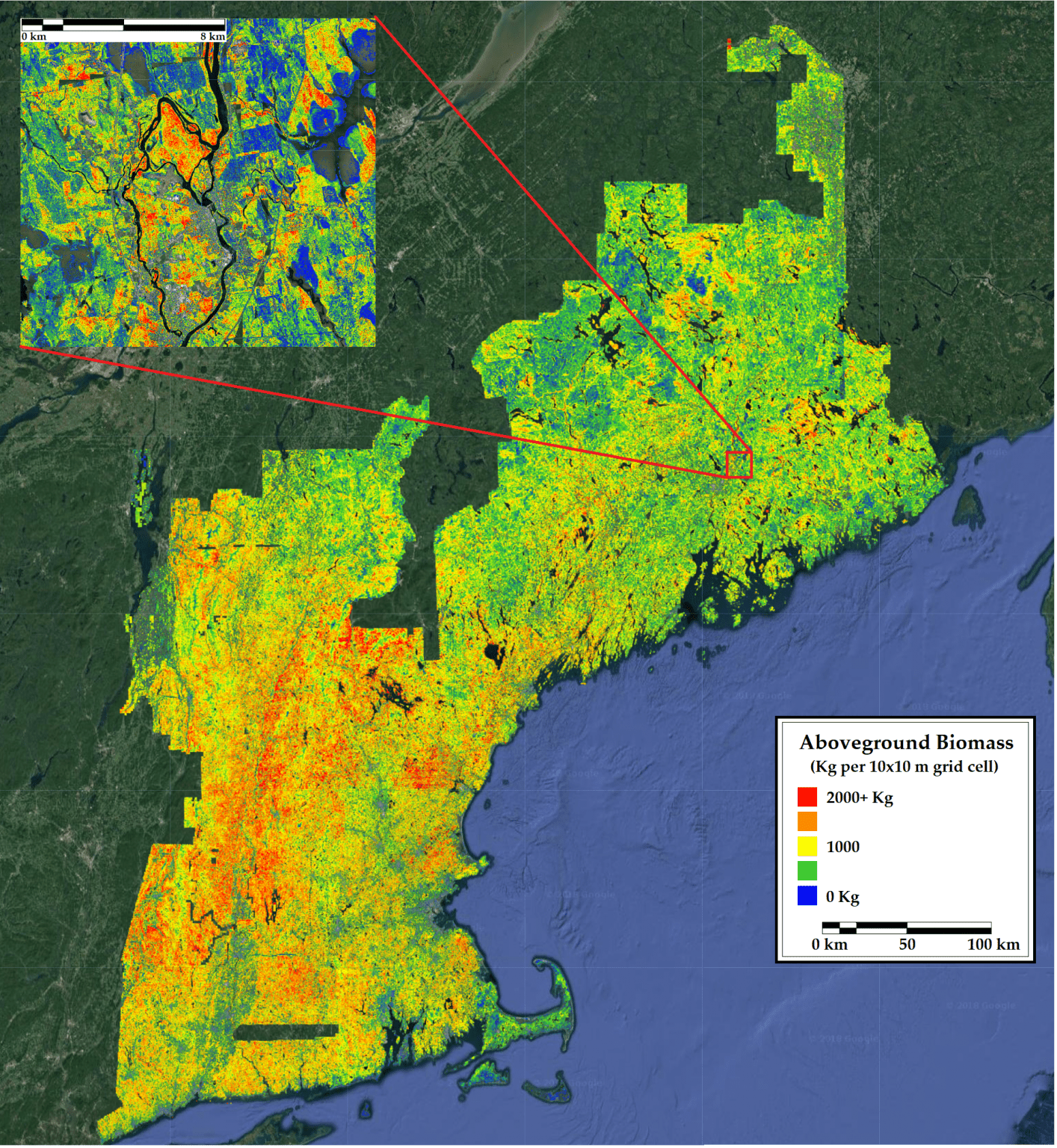
Using lasers from space and a $500,000 grant, University of Maine researchers are on a three-year mission: to help NASA develop and test methods for mapping carbon deposits and biological changes across a large, complex swath of forest.
Researchers from the Wheatland Geospatial Laboratory in the university’s School of Forest Resources and the Center for Research on Sustainable Forests were selected to join NASA’s Global Ecosystem Dynamics Investigation science team, according to a news release.
With the three-year funding, researchers will use data from NASA’s newly launched ecosystem LiDAR (Light Detecting and Ranging) instrument, orbiting the Earth on the International Space Station.
Wheatland’s director, Daniel Hayes, and the Center for Research on Sustainable Forests’ director, Aaron Weiskittel, will team up with colleagues at Michigan State University and the University of Minnesota to harness the data on their “FORest Carbon Estimation” (FORCE) project.
“This is a very exciting opportunity made possible by NASA for Maine to benefit from emerging and revolutionary technology like spaceborne LiDAR,” Hayes said in the release. “Just a few years ago it was radical to have laser scans from airplanes, and now we can get that information from outer space. And we’re excited to continue the long tradition of using Maine’s forests as an important test bed for NASA Earth science missions.”
The project will add to the larger portfolio of research conducted by Wheatland and the Center for Research on Sustainable Forests that strives to take stock of, understand and predict the health and function of forests in Maine and the larger region as they respond to changes in management, disturbances and climate.
The monitoring could play a key role in Gov. Janet Mills’ plans for reducing carbon emissions, and may provide important information about the forest sector’s role in the ongoing efforts of the Maine Climate Council.
Maine’s forest and associated industry currently offset 75% of the state’s annual carbon emissions, according to recent estimates by Center for Research on Sustainable Forests researchers. Mills has said she is hopeful for Maine to be carbon neutral by 2045 through reduced emissions and innovative policy to increase carbon sequestration.
Scientists and managers estimate carbon in forests in order to quantify sequestration and support offset programs. Carbon measurements using traditional, ground-based forest inventories are limited by their area covered and frequency of data collection. The LiDAR instrument overcomes these limitations by using laser pulses to produce detailed datasets of vegetation structure, which offer new opportunities to better monitor forests.
The team will develop and test their mapping methods at research sites in Maine, New Brunswick, Ontario and Minnesota, and then apply the approach across forests of northeastern North America, considered a challenging but useful demonstration for Global Ecosystem Dynamics Investigation data. That’s because the mix of tree species either at the northern or southern limit of their ranges come together in a complex, extensively managed forest region spanning two countries.
FORCE is one of 22 projects selected across the United States to work with the vegetation height and density data recently made publicly available from the Global Ecosystem Dynamics Investigation mission.
In New England, LiDAR data cover nearly the entire geographical extent of the region. But the region’s forest attributes have not been mapped. When used to depict three-dimensional forest canopy structure, LiDAR data are considered useful for predicting forest attributes such as biomass, stem density and species, which in turn contribute to carbon accounting, forest management and wildlife habitat characterization.
In the past few years, about $1 billion in investments have revitalized Maine’s forest products industry.
Earlier this year, NASA awarded a biology professor at University of Maine at Farmington a $300,000 grant to explore whether an instrument called ECOSTRESS (ECOsystem Spaceborne Thermal Radiometer Experiment on Space Station) on the International Space Station can help predict wildfire effects on forests in the Southwest.