Photo / Maureen Milliken
The Maine Trail Coalitions 2020-2030 state rail trail plan is looking for ways to create a state multi-use trail network, while also leaving the possiblity of train use.
Please do not leave this page until complete. This can take a few moments.
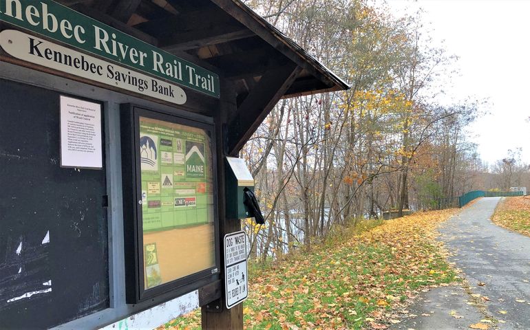 Photo / Maureen Milliken
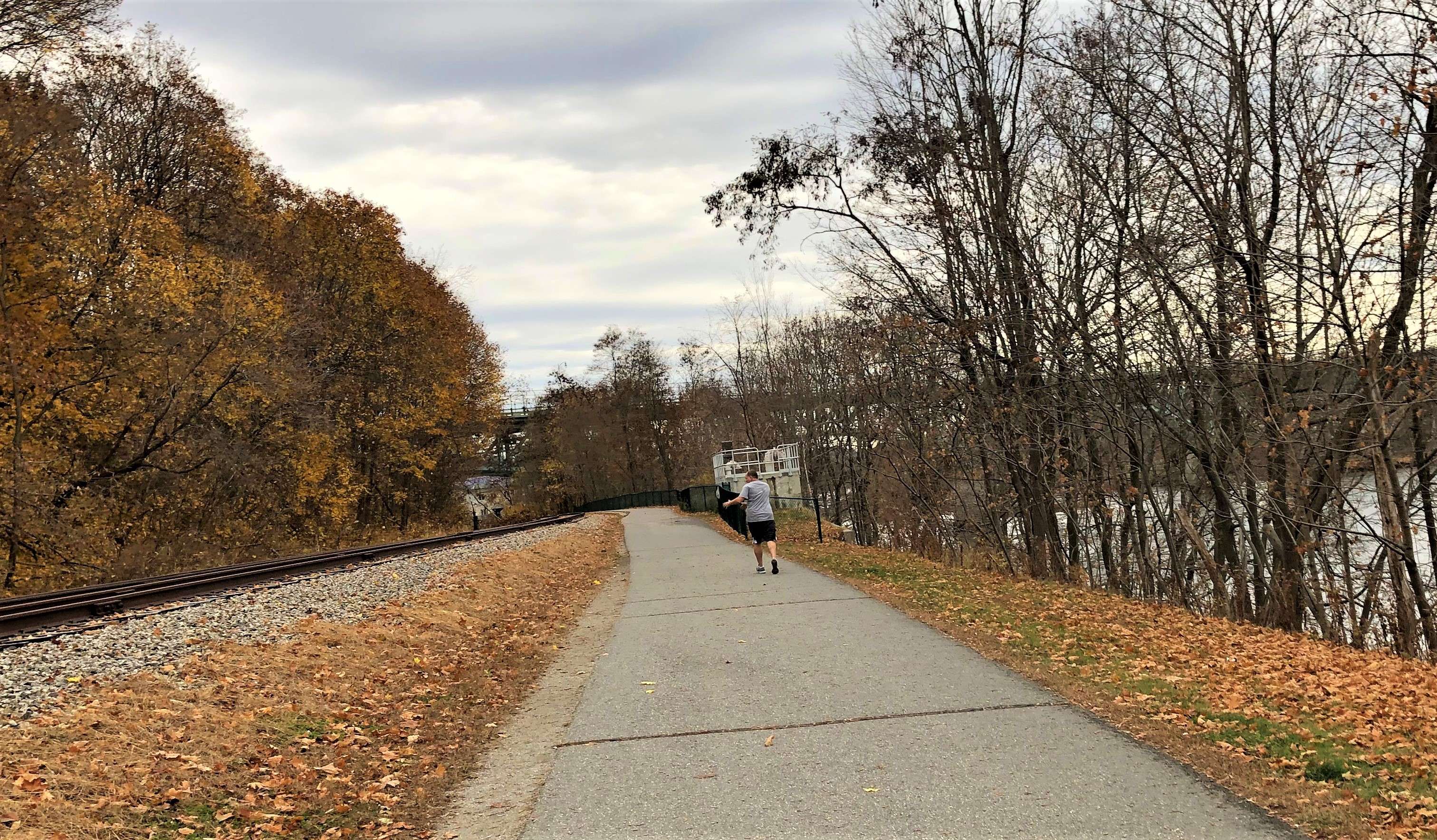
The Kennebec River Rail Trail, which runs along the rive for 6.5 miles between Augusta and Gardiner, could be part of a 13-trail statewide network in a plan recently launched by the Maine Trail Coalition.
Photo / Maureen Milliken
The Kennebec River Rail Trail, which runs along the rive for 6.5 miles between Augusta and Gardiner, could be part of a 13-trail statewide network in a plan recently launched by the Maine Trail Coalition.
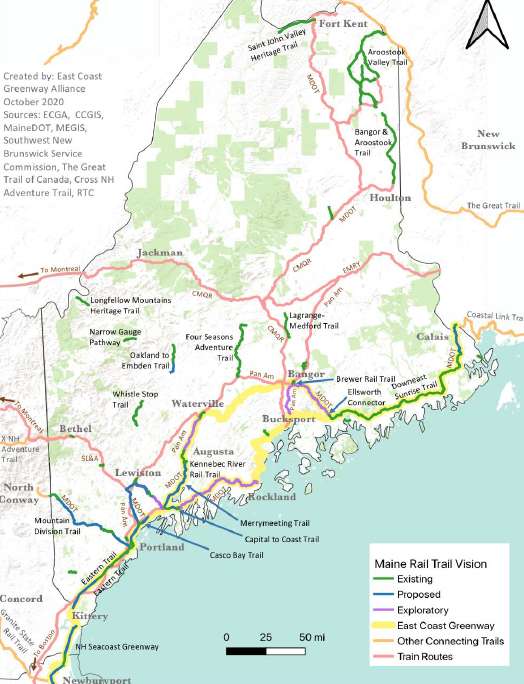
A 10-year plan that calls for a laser focus on adding up to 250 miles to the state's rail trails and creating a connected statewide network of multi-use rail trails has been published by the Maine Trails Coalition.
The plan also preserves rail lines for reuse by trains, something favored by the the majority of Mainers in a poll by the coalition.
The Maine Rail-Trail Plan 2020-2030 plan calls for construction of 13 specific rail-trail projects over the next decade, and at least five more developed over the next decade. Each of the projects connects with and extends existing multi-use trails, and creates regional connections between communities across the state, the coalition said.
The plan comes at the brink of profound societal and environmental changes that make it a critical part of future planning, said Sue Ellen Bordwell, chair of the MTC rail-trail working group. "A regional trail network is critical to public health, community, and the urgent need for emission-free transportation alternatives to reverse climate change," Bordwell said.
The plan is a first step in envisioning the possibilities for a statewide network of multi-use trails that can connect residents to community assets, open space, employment, transit and other destinations, including schools and health care centers, the coalition said in a news release.
The coalition was formed last year and is seeking ways to capitalize on the state's unused rail corridors, as well as draw visitors and boost economic development, both in rural areas and downtowns.
Moving forward with rail-trail development would also capitalize on Maine’s brand as an outdoor recreation destination, attracting visitors to rural and urban Main Streets and businesses.
The idea is one supported by a large majority of Mainers regardless of political leaning, according to a poll commissioned last year by the Maine Trails Coalition. Some 86% of Mainers support creating multi-use trails on unused rail corridors as long as they can be converted back to railroad use if needed. The poll shows 87% of Democrats polled strong agree, as do 83% of Republicans and 88% of independent voters.
In addition to their public health, environmental and community benefits, regional trail systems provide a multifold return on investment in the form of local economic impact and tourism, the MTC said.
The plan calls for continuing to preserve and maintain a separate and active rail corridor that can be used to extend future Amtrak, commuter train, or freight service from Boston through Maine's largest population centers.
The plan lists 37 existing trails and 13 more, most in southern and central Maine. Another 13 that could be constructed, connecting the existing trails, range in length from a 32-mile Oakland-to-Embden trail in Kennebec and Somerset counties, and a 31-mile Gorham-to-Fryeburg trail in Cumberland and Oxford counties, to a 1-mile Ellsworth connector.
The five exploratory trails connect regions, and many are part of the East Coast Greenway. The plan, in fact, would bring much of the northern end of the 3,000-mile East Coast Greenway close to completion. The proposed projects in the plan would nearly completed the corridor from the New Hampshire border to Waterville, and from Bangor to Calais, put more than 80% of Maine’s ECG corridor off-road and safe from car traffic for those using it.
The greenway has become the most visited “park” in America, according to the trails coalition. The East Coast Greenway, once completed, would be a fully connected bike and walking path, safe from cars, that runs from the top of Maine to the bottom of Florida. Roughly 1,000 miles have been built to date, and the remaining 2,000 miles are in various stages of visioning, planning and design at the local, regional, and state levels.
The plan illustrates that the most important inter-urban corridors don't require a choice between trains and trails, but that there are alternate routes that allow for both, the coalition said.
"A regional multi-use trail network is complementary to expanding transit in Maine and can provide connections from where people live to transit, increasing the potential service area for future passenger rail," it said.
The coalition said it plans to refine the plan over time as communities, regional authorities, state agencies and other interest groups weigh in.

The Giving Guide helps nonprofits have the opportunity to showcase and differentiate their organizations so that businesses better understand how they can contribute to a nonprofit’s mission and work.
Learn More
Work for ME is a workforce development tool to help Maine’s employers target Maine’s emerging workforce. Work for ME highlights each industry, its impact on Maine’s economy, the jobs available to entry-level workers, the training and education needed to get a career started.
Learn More
Whether you’re a developer, financer, architect, or industry enthusiast, Groundbreaking Maine is crafted to be your go-to source for valuable insights in Maine’s real estate and construction community.
Learn moreThe Giving Guide helps nonprofits have the opportunity to showcase and differentiate their organizations so that businesses better understand how they can contribute to a nonprofit’s mission and work.
Work for ME is a workforce development tool to help Maine’s employers target Maine’s emerging workforce. Work for ME highlights each industry, its impact on Maine’s economy, the jobs available to entry-level workers, the training and education needed to get a career started.
Whether you’re a developer, financer, architect, or industry enthusiast, Groundbreaking Maine is crafted to be your go-to source for valuable insights in Maine’s real estate and construction community.
In order to use this feature, we need some information from you. You can also login or register for a free account.
By clicking submit you are agreeing to our cookie usage and Privacy Policy
Already have an account? Login
Already have an account? Login
Want to create an account? Register
In order to use this feature, we need some information from you. You can also login or register for a free account.
By clicking submit you are agreeing to our cookie usage and Privacy Policy
Already have an account? Login
Already have an account? Login
Want to create an account? Register
This website uses cookies to ensure you get the best experience on our website. Our privacy policy
To ensure the best experience on our website, articles cannot be read without allowing cookies. Please allow cookies to continue reading. Our privacy policy


0 Comments